Planning for NWS Earle
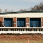
Monmouth County has received a $206,000 federal grant from the Department of Defense to prepare a Joint Land Use Study (JLUS) for Naval Weapons Station Earle.
A cooperative land use planning effort between affected local government entities and the military installation, the project looks to create compatible development measures to keep the base operational, while also looking out for the surrounding public’s health, safety, and welfare. When land use decisions impair the effectiveness of a military base, the utility of the installation and its mission can be compromised. Mission constraints can lead to base closure. Monmouth County will contribute $32,500 in staff time and materials to the study.
“We look forward to working with the DOD and coordinating our efforts with mayors from Colts Neck, Howell, Middletown, Tinton Falls, and Wall, land and water-use experts, academia and the public at large,” said Freeholder Serena DiMaso. “We want to do everything we can to position NWS Earle for the future and keep it operating effectively in Monmouth County,” she added.
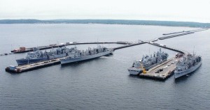
NWS Earle is a United States Navy base with Mainside operations in Colts Neck, Howell, Wall and Tinton Falls and a Waterfront Pier Complex on the Sandy Bay in the Leonardo section of Middletown. The two parts are connected by 15 miles of road and rail. The base encompasses 11,851 acres of Monmouth County and has a direct economic impact of $160 million on the area.
The station, named for Rear Admiral Ralph Earle, the Chief of the Bureau of Ordnance during World War One, was built in 1943. The facility handles, stores, transports, renovates and issues all types of weapons and ammunition for the Atlantic Fleet of the Navy, Marines and Coast Guard. Earle serves over 2,000 military DoD civilians and families. It is the homeport to USS Seattle, USS Detroit, USS Supply, USS Arctic, and Combat Logistics Group 2.
The Military Influence Area of the station includes the five hosting communities and Atlantic Highlands, Highlands, Eatontown, Farmingdale, Freehold Township, Keansburg, Neptune, and Ocean Township. The watersheds that impact Earle’s operations in the Sandy Hook and Raritan Bays extend to Aberdeen, Fair Haven, Hazlet, Holmdel, Keyport, Little Silver, Long Branch, Marlboro, Matawan, Monmouth Beach, Oceanport, Red Bank, Rumson, Sea Bright, Shrewsbury Borough, Shrewsbury Township, Union Beach and West Long Branch.
“This particular JLUS is somewhat unique in that it will include climate adaptation planning as a major component of the study to benefit both NWS Earle and the surrounding communities with recommendations to improve their sustainability from sea level rise and resiliency from coastal storms,” said Freeholder Lillian G. Burry. “We must pay close attention to preserving the economic impact NWS Earle has on our community and this grant is the perfect way to get these needed conversations underway.”
The goals of the study include, encouraging local governments to work closely NWS Earle to seek to development options that are compatible with continued utility of the base, and that preserve and protect the public health, safety, and welfare of those living near this active military installation. To improve post-storm resiliency within NJ’s Monmouth Coastal Watershed, for the military installation and surrounding communities through increased adaptation to adverse impacts from Sea Level Rise, both on base and in the neighboring communities To ensure preservation, protection, and post-storm resiliency of the Strategic Highway Network including the Normandy Road/Rail Corridor and the major roadways that serve NWS Earle and the surrounding communities.
Highways within Monmouth County that provide local access to NWS Earle, together with those that are part of the Strategic Highway Network, include: New Jersey State Routes 18, 33, 34, 36; the Garden State Parkway; US Route 9; and Interstate 195.
The County will seek input on the development of the study from many sources. Serving on the JLUS Policy Committee are the Monmouth County Freeholders, County Administrator, NWS Earle Commanding Officer (ex-officio), Monmouth County Planning Director, Monmouth County Director of Public Works and Engineering. There will also be a General Advisory Committee formed with staff from six County Departments, plus representatives from NWS Earle, The NJ Dept. of State Office for Planning Advocacy, and all municipalities within the Military Influence Area of NWS Earle.
Public Meetings will be held as milestones are reached during the study period to seek public input and brief interested parties about the purpose of the JLUS, the planning process, and study recommendations.


