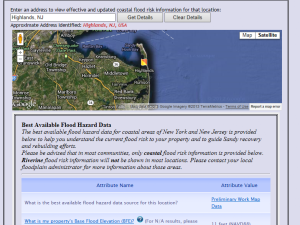
FEMA has updated its Base Flood Elevation maps for Atlantic, Hudson, Monmouth and Ocean counties.
Residents and businesses can enter the address of their properties and find their flood zone designation, the base flood elevation for the property and the estimated ground elevation of the location.
The interactive map site can be found here or by clicking on the picture.

Posted: June 17th, 2013 | Author: Art Gallagher | Filed under: #STTS, FEMA, Flood Maps, Flooding | Tags: A zone, FEMA, Flood Maps, V zone | 1 Comment »
Middletown Patch is reporting that FEMA will release new flood maps for Atlantic, Hudson, Monmouth and Ocean Counties on Monday, June 17.
As expected, the new ‘preliminary’ maps will result in less homes being located in ‘V’ zones than were so rated in the maps released by FEMA in December following Superstorm Sandy. V zones are areas along coasts that are subject to inundation by the 1-percent-annual-chance flood event with additional hazards associated with storm-induced waves.
Many of the properties located in V zones in the December flood maps will be in ‘A’ zones in the maps being released next week, according to a statement by U.S. Senator Bob Menendez as quoted by Patch.
A zones are also subject to the 1-percent annual-change flood event (100 year flood) but without the additional hazards from waves.
Homes in A zones will not have to be raised as high and homes in V zones and will have lower flood insurance premiums.
Posted: June 13th, 2013 | Author: Art Gallagher | Filed under: FEMA, Flood Maps, Flooding, Hurricane Sandy, Superstorm Sandy | Tags: FEMA, Flood Maps, Flood zones, Middletown Patch, Senator Bob Menendez, Superstorm Sandy | Comments Off on Report: New flood maps to be released on Monday
Governor Chris Christie told a Manasquan Town Hall crowd of approximately 1200* that he expects FEMA will release an expedited set of flood elevation maps in “a few months” that will ease the height requirements from the Advisory Maps published in December, according to The Star Ledger.
Christie said he adopted the recommendations in FEMA’s advisory maps earlier this year for those who need guidelines now on how to rebuild. For those who can wait to rebuild, a new set of maps should be out “in a few more months” that he said will be less “aggressive” in placing homes in flood zones.
“I’m confident the maps are going to change,” he said to a crowd of more than 300 in the Manasquan High School gym. “The only thing I’m not confident about is when.”
* MMM has learned from someone at the Town Hall that the crowd was approximately 1200, not the 300 originally reported by The Star Ledger.
Posted: March 21st, 2013 | Author: Art Gallagher | Filed under: Chris Christie, FEMA, Flood Maps | Tags: Chris Christie, FEMA, Flodd Elevation Maps, Flood Maps | Comments Off on Christie At Manasquan Town Hall: FEMA will issue less severe elevation maps

